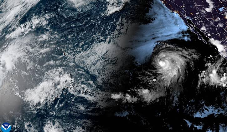
The storm continued moving across the eastern Pacific Ocean on Saturday, but forecasters said it is not expected to reach land and will likely lose strength quickly.
According to the U.S. National Hurricane Center based in Miami, the hurricane was located roughly 1,160 miles (1,865 kilometers) west-southwest of Mexico’s Baja California peninsula.
Gil was moving toward the west-northwest at around 20 mph (31 kph), with top sustained winds near 75 mph (120 kph).
Although Gil reached hurricane strength, there were no alerts or warnings issued for any coastal areas.
Meteorologists expect the storm to weaken by late Saturday and continue losing power through the weekend.
It could transition into a post-tropical system as early as Sunday.
This Hurricane Gil update comes as part of the broader monitoring of multiple weather systems in the eastern Pacific, a region that sees high activity during the summer hurricane season.
Another storm, Iona, which had previously reached hurricane status, has already been downgraded to a tropical depression.
It is located far west of Hawaii and is not posing a risk to any land areas.
Forecasters also mentioned the possibility of more tropical systems forming in the eastern Pacific over the next few days.
However, none of the current storms are expected to make landfall or affect populated regions.
While the Pacific basin remains active, no immediate danger is forecast for coastal communities in Mexico, Hawaii, or other nearby areas.
Officials continue to monitor all developments closely during this busy period.