Some residents of Juneau, Alaska, are leaving their homes after meltwater from a basin dammed by the Mendenhall Glacier began spilling into the Mendenhall River, raising fears of record flooding in the state’s capital.
The National Weather Service (NWS) issued a flood warning as the fast-flowing water threatened neighborhoods downstream.
Local authorities had cautioned for days that evacuations could be necessary.
By Tuesday, they confirmed that the ice dam holding back the basin water had started to fail.
On Tuesday morning, the river level measured 9.85 feet (3 meters), still below the major flood threshold of 14 feet.
By early Wednesday, water levels surged past 16 feet, which is considered the crest for the area.
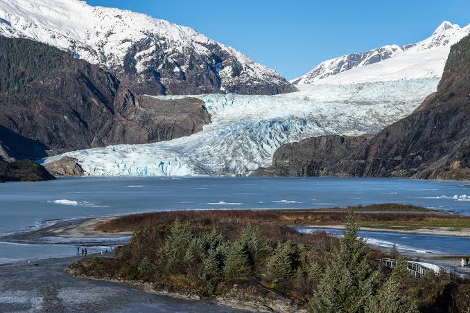
The Mendenhall Glacier, a well-known tourist destination, sits about 12 miles (19 kilometers) from downtown Juneau.
When meltwater in the basin rises high enough, it can overtop or break through the natural ice barrier, releasing large amounts of water in a short period—similar to draining a bathtub.
Governor Mike Dunleavy declared a state disaster on Sunday in anticipation of what officials describe as a potentially catastrophic glacial lake outburst flood.
Flooding events linked to the glacier have occurred annually since 2011, damaging or destroying homes. In 2024, hundreds of properties were impacted.
Scientists note that glaciers worldwide are shrinking due to rising temperatures, which increases meltwater accumulation and the formation of glacial lakes.
Natural ice and rock dams that contain these lakes can fail without warning, unleashing destructive floods. Researchers believe climate change is likely to raise the frequency of such events in the coming years.